Days 22-26 Black Hills, South Dakota
Day 22 - 20 June (120 miles to Orville Campground, near Hill City SD)
After having a thunder storm wreck our tent, we should be glad to leave Badlands NP. The rest of the visit, however, was great and we'd go again--just with a greater appreciation of the precautions needed when thunderstorms approach.
 Our main stop was Rapid City, SD. This town gets a lot of summer visitors to the Black Hills and Mt. Rushmore, and is proud of using tourism to bolster the city.
 We hung out at Starbucks long enough to check email and upload some photos. Then we took a stroll around the CBD which included this park -- just right for a hot day.
 Rapid City -- City of Presidents. The city promotes its statues of US presidents. There is one on every street corner downtown and they have one for each former president, with Barack Obama coming soon. Here is Midge with John Adams.
There are also the more usual forms of memorials.
One back alley is noted for its street art.

Day 23 - 21 June (48 miles)

We moved into Oreville Campground in Black Hills National Forest. With our tent out of commission, we spent another night in the van. At about 11PM we had hail the size of large marbles that left a few dents in the roof. When will the night time adventures end?
We cooked porridge for breakfast.
The first stop was Mount Rushmore
The busts of the presidents were huge, though not as big as Ed remembered them from over 50 years ago.
After Mount Rushmore, we took Iron Mountain Road toward Custer State Park.
Lunch at Center Lake, Custer State Park
We walked to Cathedral Spires.
All around the State Park there are piles of dead trees and cut logs.
A sign on the track explained this is called 'chunking', designed to control mountain pine beetles.
Day 24 - 22 June (94 miles)
Wildlife Loop, Custer State Park
Burros once carried tourists up Mt Harney. Now they are feral in the park.
Bison
State Game Lodge, Custer State Park
Mount Coolidge Lookout
Purple Pie Place, Custer SD
This is one of 900 places featured in the book Road Food.
The pie was great, we just should have had the courage to try the Raspberry Rhubarb Jalapeño Pie
In the afternoon we walked up the trail to Little Devil's Tower in Custer State Park. On the way up a marmot was barking at us.
Our trail branched off the main track to Mt Harney
Views from the near the top, including these pictures of Mt Harney
Heading back down.
Day 25 - 23 June (81 miles)

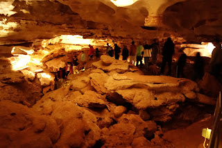
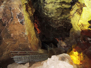
Up early. A quick bowl of porridge and then off to Wind Cave National Park to beat the crowds. We got on the 9.40am tour with Ranger Jeri, an avid caver from Kentucky. The first step was to take an elevator down into the cave.
Wind Cave is particularly noted for its boxwork
Sign on a surface trail explaining the location of the cave.
Wind escaping from original cave entrance was strong enough to blow back this little girl's hair.
Studies of this barometric wind indicate that less than 5% of the volume of the cave has been discovered and thus this is one of the largest cave systems in the world.
Picnic in Wind Cave NP
Walk to Coolidge Fire Tower
Afternoon tea at Blue Bell Lodge, Custer State Park
Day 26 - 24 June (274 miles to KOA at Buffalo, Montana)

Jewel Cave National Monument is about 30 miles NW of Wind Cave National Park. Jewel Cave is home to nine species of bat. There is no evidence the two cave systems are connected. We took the 80-minute Scenic Tour.
The cave formations in Jewel Cave are different from those in the part of Wind Cave that we saw. There was little box work but a lot of nailhead spar.
There is also flowstone, stalactites, stalagmites, draperies
This is a straw, connected at both top and bottom.
A long ribbon drapery called the cave bacon.
There is some green algae growing in the cave as a result of incandescent and fluorescent lighting.
We continued North to Devil's Tower National Monument in NE Wyoming.
There was a queue of cars waiting to get in. Drivers and the lone gate attendent acted like they could chat all day.
We walked around the base, saw remnants of the wooden ladder, and wondered how all those hexagonal basalt columns formed and stay in place.
Prairie dog near the entrance to Devil's Tower.
passing through Gillette WY
Gillette calls itself the "Energy Capital of the Nation", and is at the center of developing coal, oil, and coalbed methane gas resources.
By early evening we were at the KOA campground in Buffalo WY and on the eastern edge of the Bighorn Mountains.


